AV21 Strategy: Flash Floods under Conditions of Environmental Change
Project duration: 2023–2027
Co-investigator at CzechGlobe: RNDr. Jiří Jakubínský, Ph.D.
- Within the AV21 Strategy, our department focuses on the flash floods under conditions of environmental change, which is part of the Dynamic Planet Earth research programme.
▶ What is the AV21 Strategy?
- Flash processes (e.g. flash floods, debris flows or mudflows) are hazardous hydromorphological phenomena characterised by their sudden onset and specific hydrological and sedimentary regimes. The complex nature of these events, caused by extreme meteorological conditions and closely linked to the geological and geomorphological characteristics of the area, vegetation, and land-use patterns, necessitates the use of detailed analyses of causal processes when studying these phenomena. Identification of the main causes of these flash processes is crucial for the planning and implementation of preventive measures within individual catchments.
- The primary objective of the research activity is to assess the potential use of remote sensing methods (in particular unmanned aerial systems – UAS – and terrestrial laser scanning) for the analysis of grain-size distribution and clast orientation (i.e. sediment particles such as pebbles, cobbles, etc.) in river channels.
This approach makes it possible to obtain information on transport dynamics, flow type and flow energy under depositional conditions. Traditional manual methods rely on extensive and time-consuming field surveys involving measurements of clast size and the collection of bulky samples for laboratory analyses. Moreover, these methods are often affected by subjectivity. Methods based on 3D data – especially analyses of point clouds acquired by terrestrial laser scanners – represent a major innovation, as they enable the processing of large datasets acquired at a single point in time over relatively extensive areas. Recent advances in algorithms now allow granulometric analysis to be performed directly from 3D point clouds using specialised software. Such data subsequently help to reveal how and why a river changes – where new gravel bars form, where bank erosion may occur, or how a river responds to floods or human interventions.
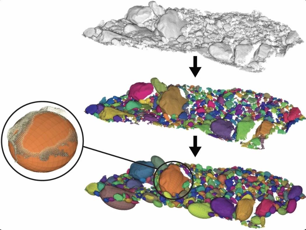
Processing of 3D laser scanning data of gravel bars: individual clasts are identified in the point cloud using specialised software and subsequently described geometrically by ellipsoids representing clast size and orientation.
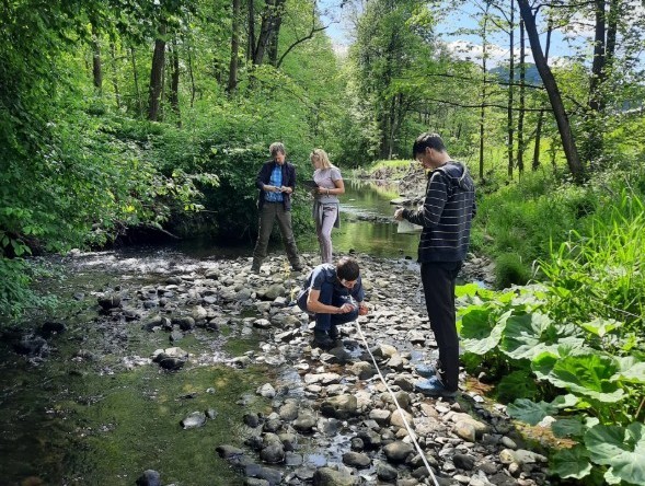
Manual measurement of morphometric parameters of a gravel bar on the Senice River in the Javorníky Mountains.